I’m going to use this post to provide updates on Winter Storm Fern, specifically with regards to its potential (and actual, once it starts) impacts on Virginia. Some meteorologists (in addition to the National Weather Service, of course) and other weather-related sites I follow include: Matthew Cappucci, Capital Weather Gang, Doug Kammerer, Blue Ridge Weather, Matt DiNardo, WxRisk.com, Justin Berk, Jay’s Wintry Mix, the Weather Channel, etc.). Oh, by the way, the storm has been nicknamed “Fern” by The Weather Channel – not an official National Weather Service name or anything…
P.S. Since this is a political website, it’s worth mentioning that this storm could make it very difficult for legislators to get back and forth from Richmond early next week. Also, this will be the first big weather-related test for Gov. Spanberger’s administration…
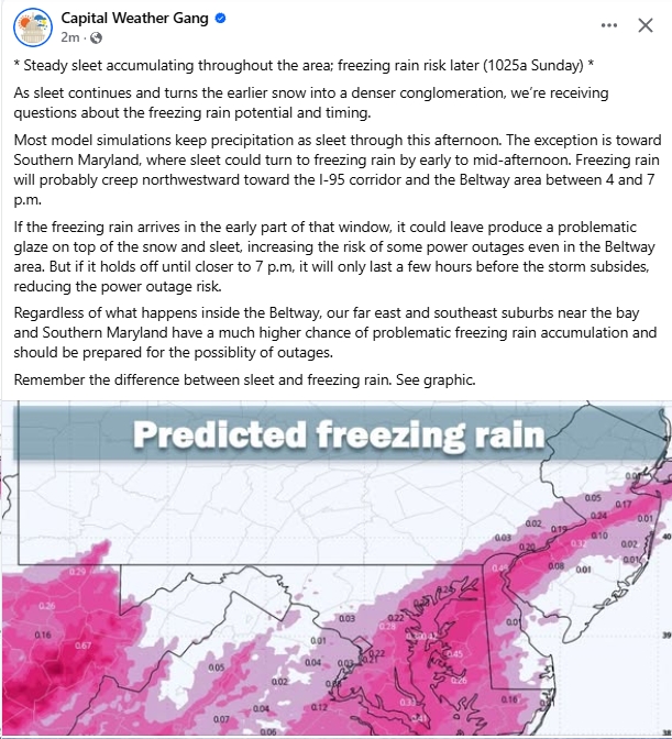
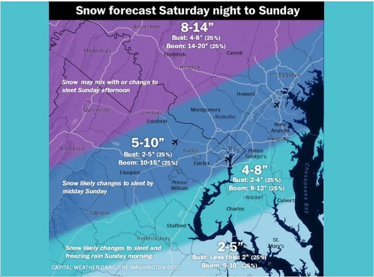
UPDATE 10:30 am Sunday from the Capital Weather Gang:
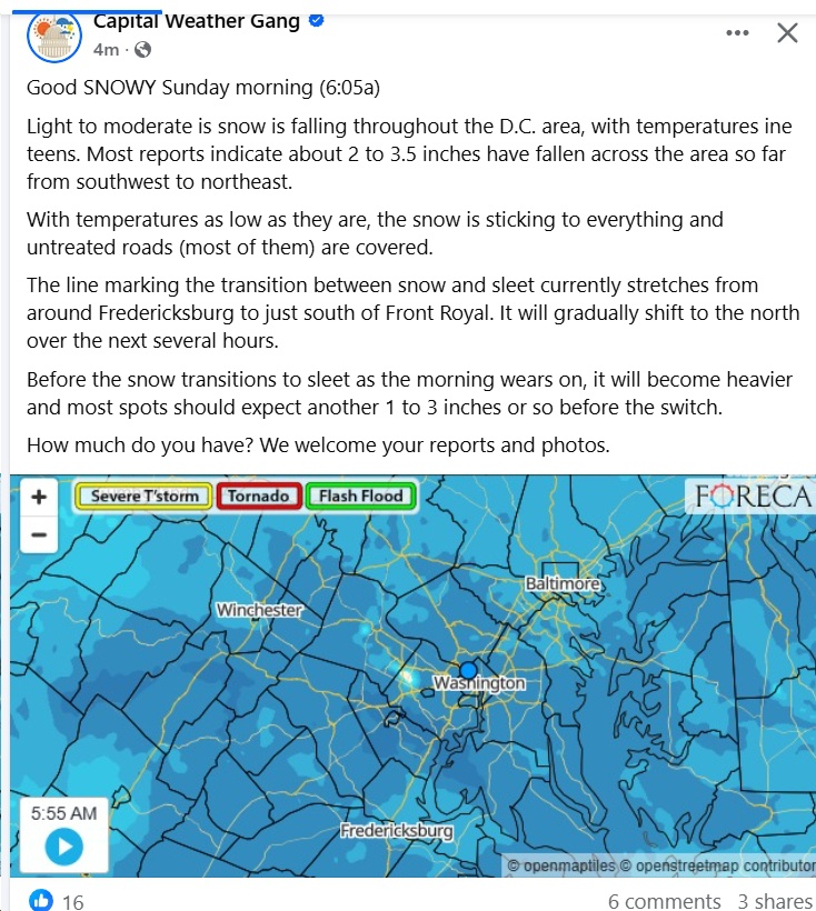
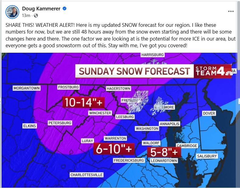
UPDATE 6 Sunday from the Capital Weather Gang:
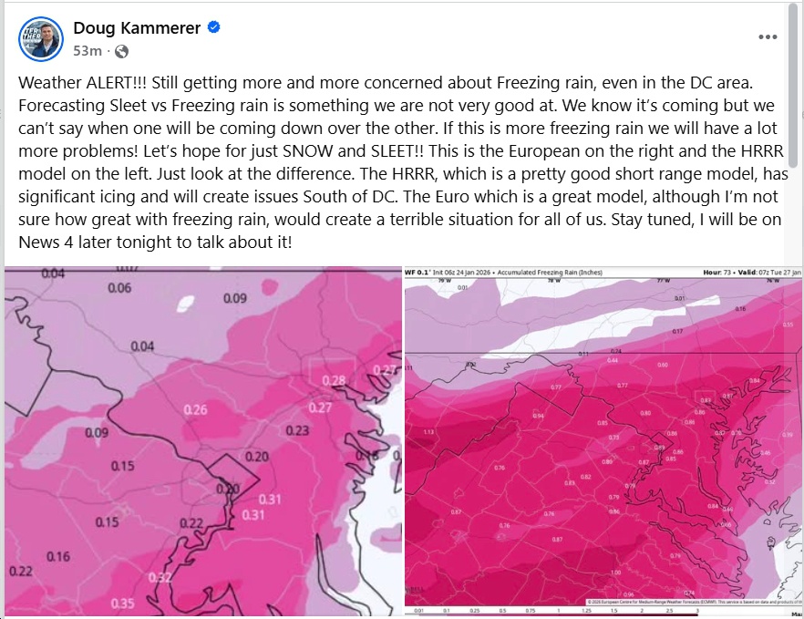
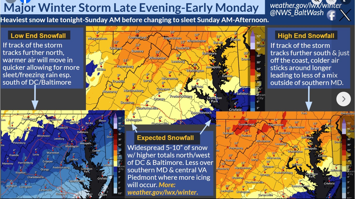
UPDATE 10:30 am Saturday from Doug Kammerer:
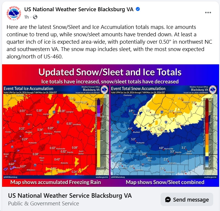
UPDATE 6:20 am Saturday from the National Weather Service:
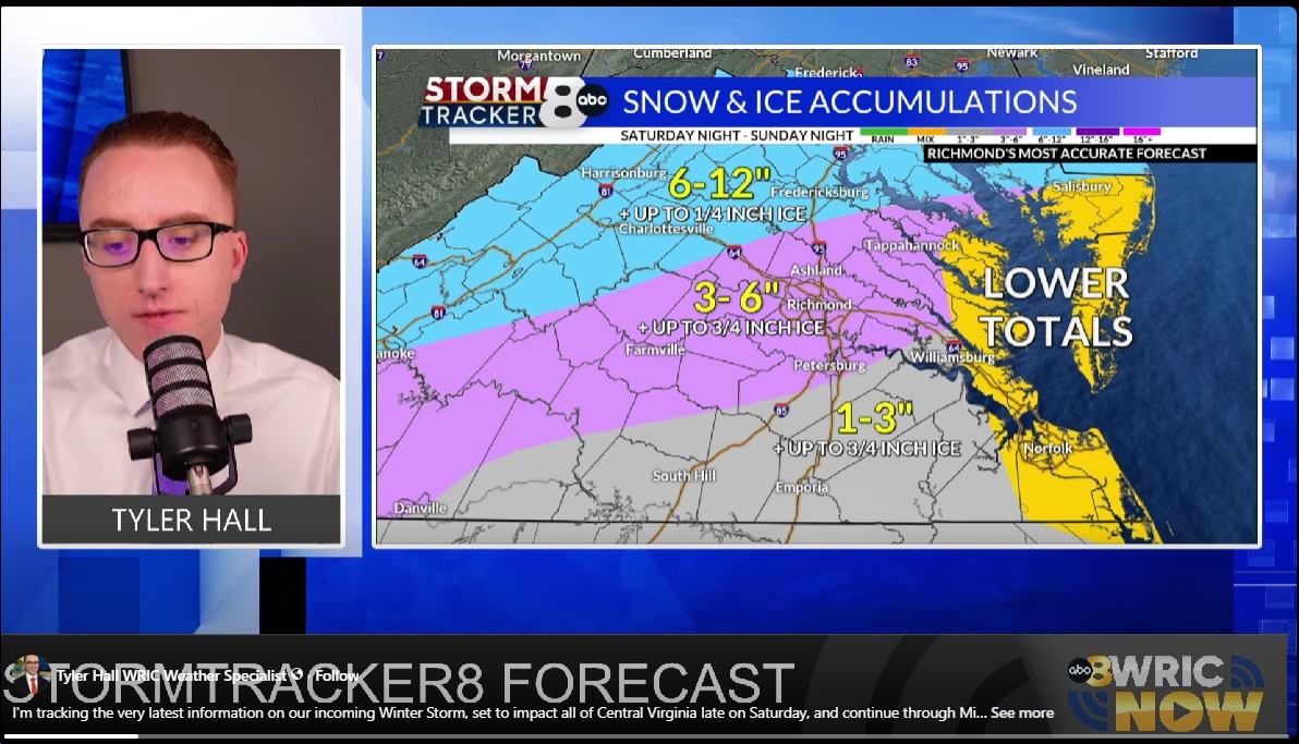
UPDATE 3 pm from StormTracker8:
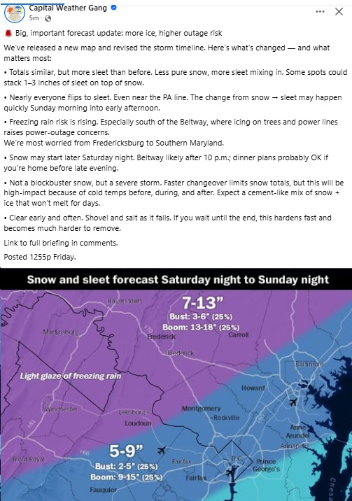
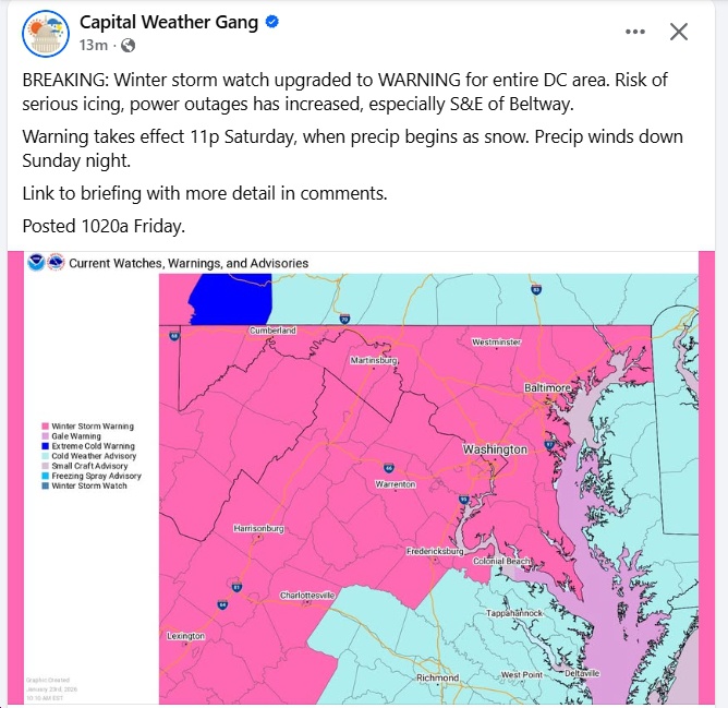
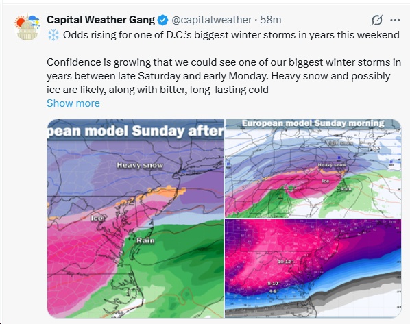
UPDATE Friday 1 pm from the Capital Weather Gang…
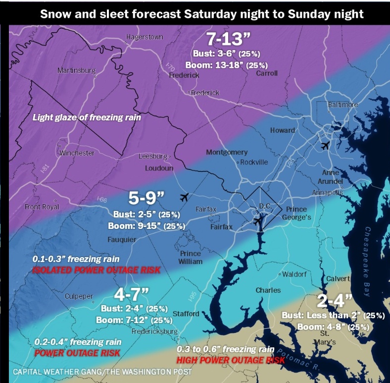
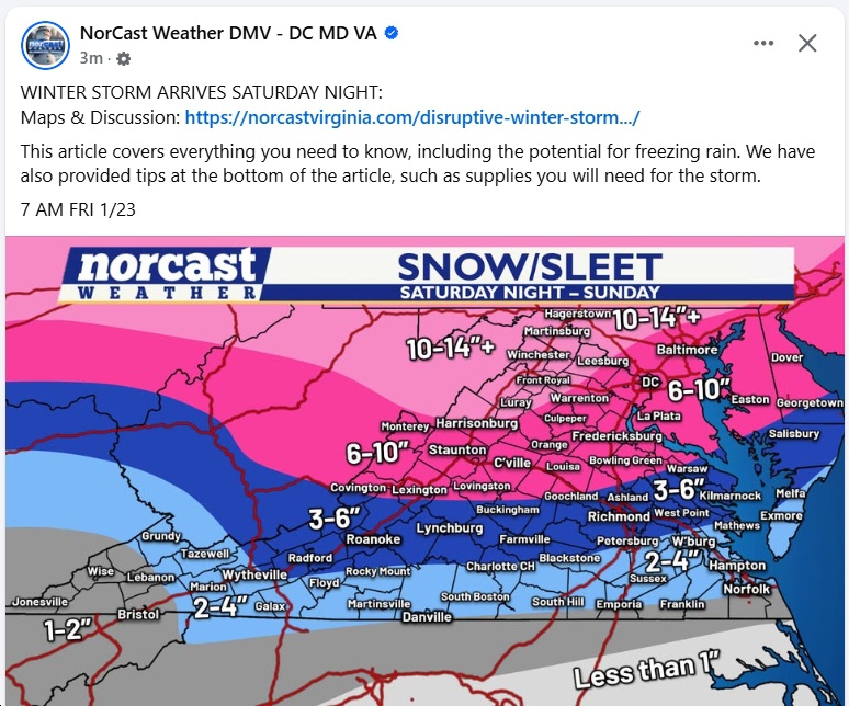
UPDATE Friday 10:30 am from the Capital Weather Gang…
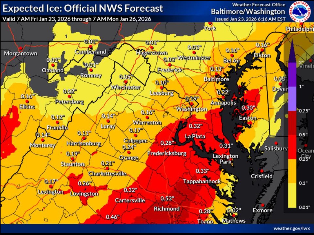
UPDATE Friday 7:47 am – Tons of info here (e.g., “When the transition to freezing rain occurs and how much freezing rain falls remain the two biggest questions. The European model has trended colder but still shows a significant amount of freezing rain. The GFS, Canadian, and NAM models favor more sleet. At this time, a decent amount of freezing rain (at least one-quarter inch) is likely across Central and South Central Virginia, as well as parts of Southwest Virginia, from Sunday afternoon through Sunday night. More sleet would limit power outages, but once ice accretion approaches one-quarter inch, the risk of numerous to widespread power outages becomes a serious concern.”)
From the National Weather Service Friday morning
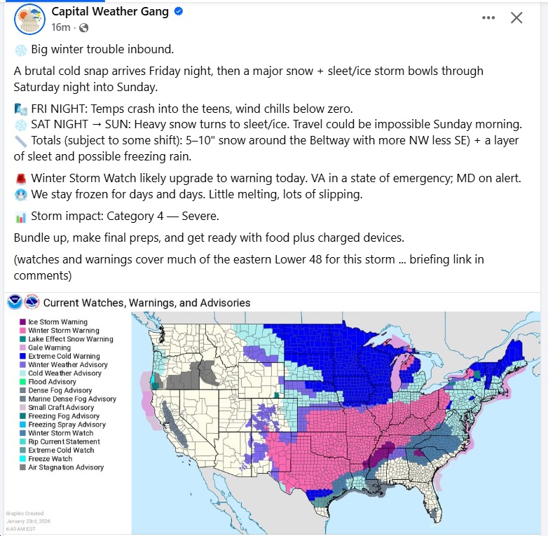
UPDATE 7 am Friday from the Capital Weather Gang
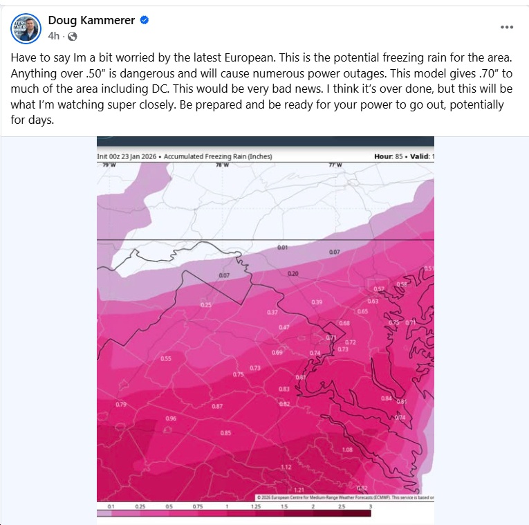
UPDATE 5:50 am Friday from Doug Kammerer
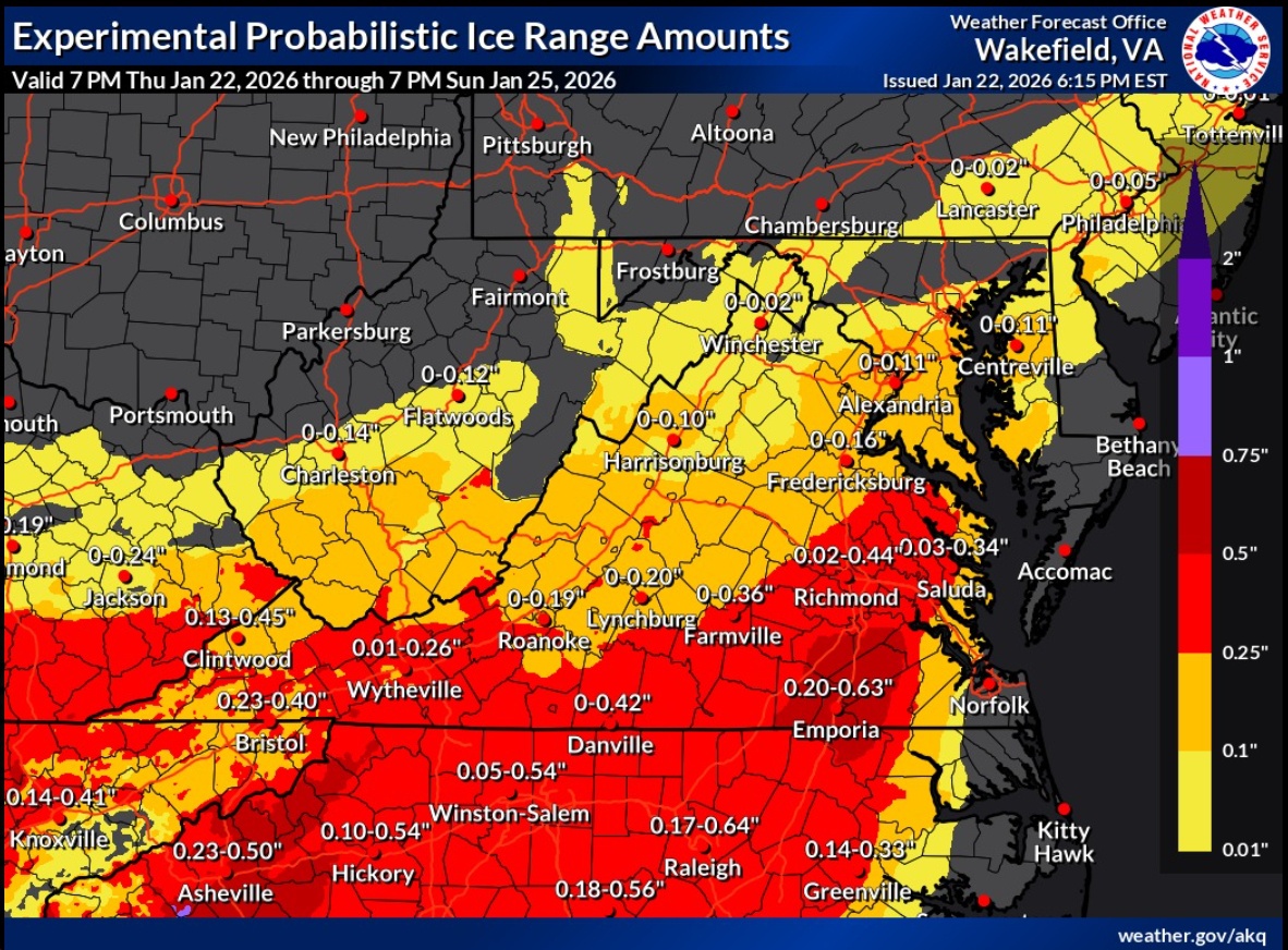
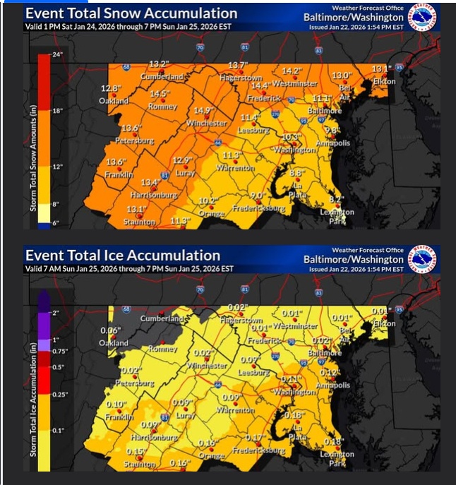
UPDATE 7 pm Thursday from the Weather Forecast Office/National Weather Service in Wakefield, VA
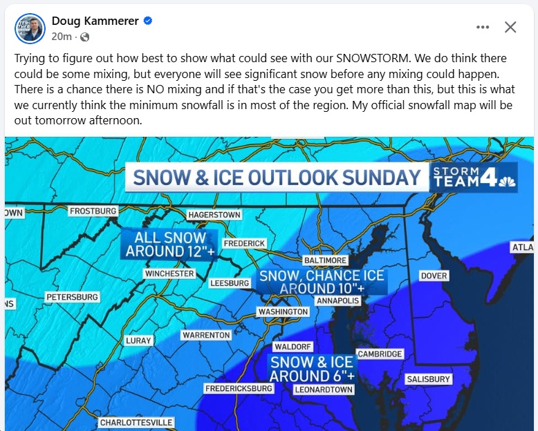
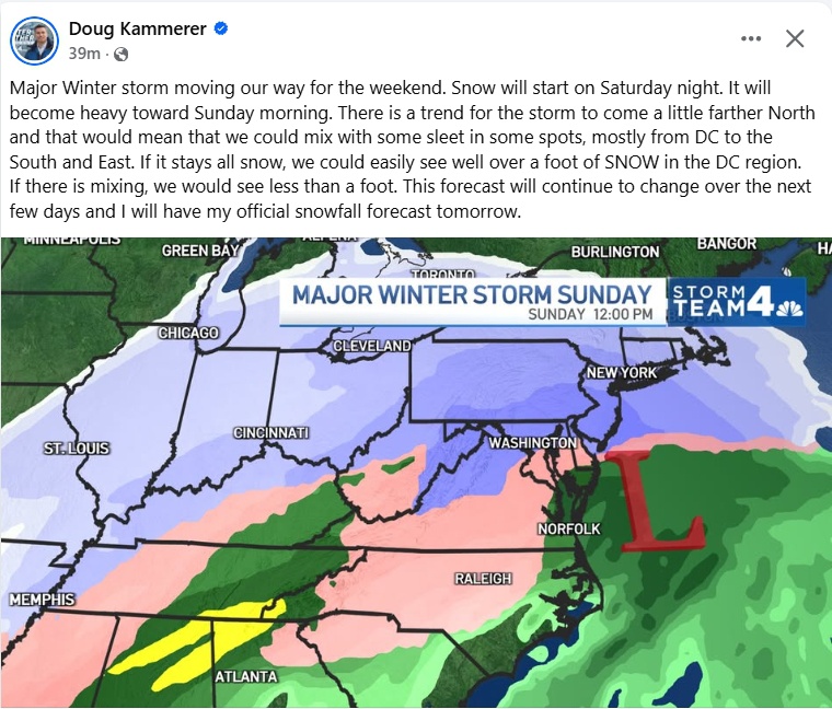
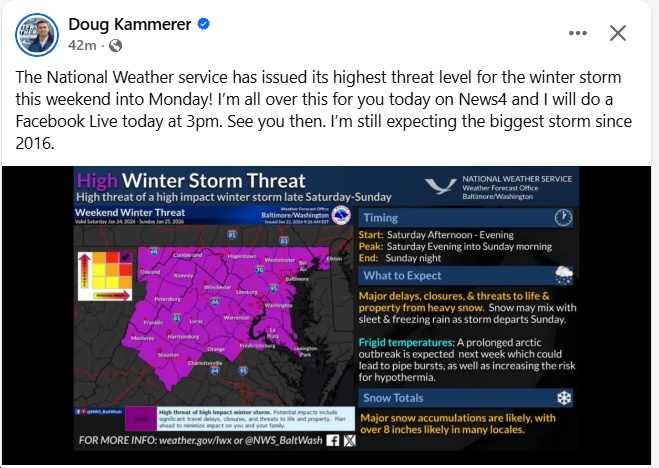
UPDATE 4:45 pm Thursday from Doug Kammerer:
UPDATE 3:25 pm Thursday: From the National Weather Service
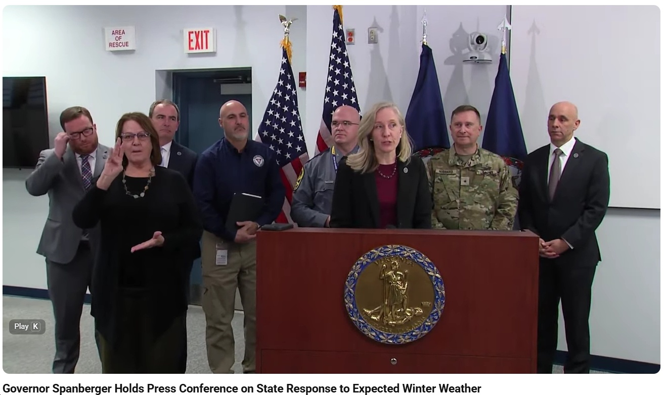
UPDATE 12:52 pm Thursday: See here for Governor Spanberger’s Press Conference on the State Response to Expected Winter Weather
UPDATE 12:48 pm Thursday from Capital Weather Gang:
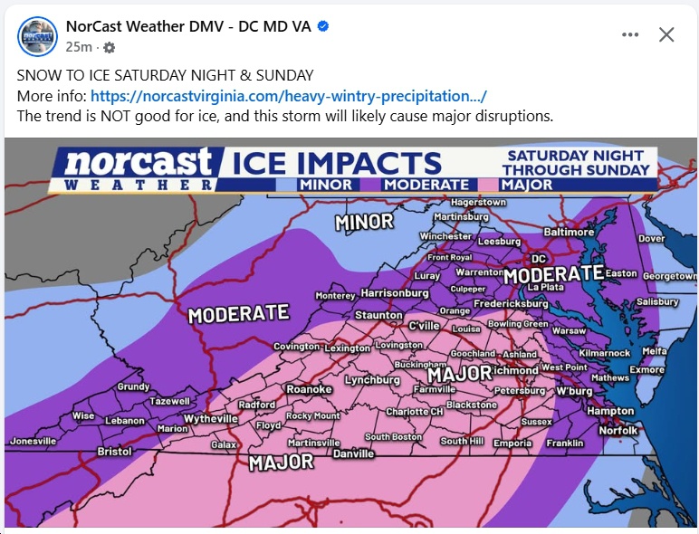
UPDATE 9:24 am Thursday from Blue Ridge Weather: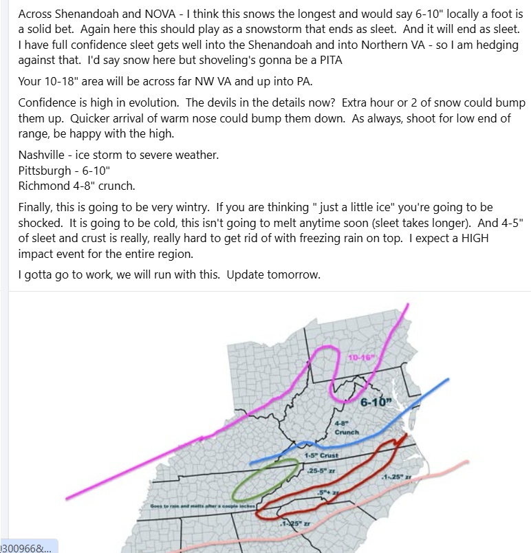
UPDATE 7:08 am Thursday:
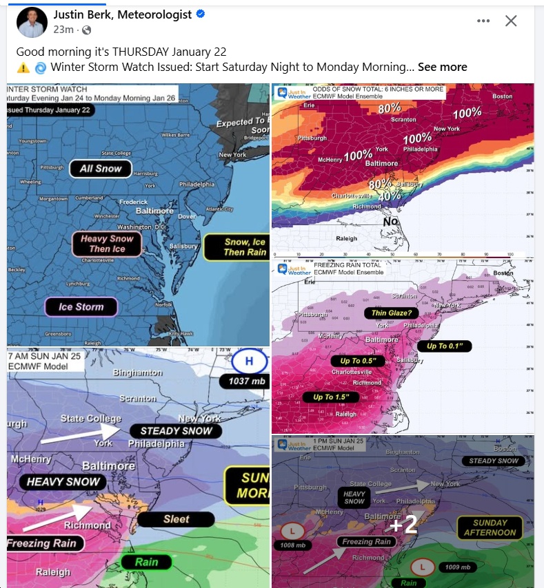
UPDATE 6:07 am Thursday:
UPDATE 6:05 pm Wednesday:
UPDATE 4:55 pm Wednesday:
UPDATE 4:22 pm Wednesday:
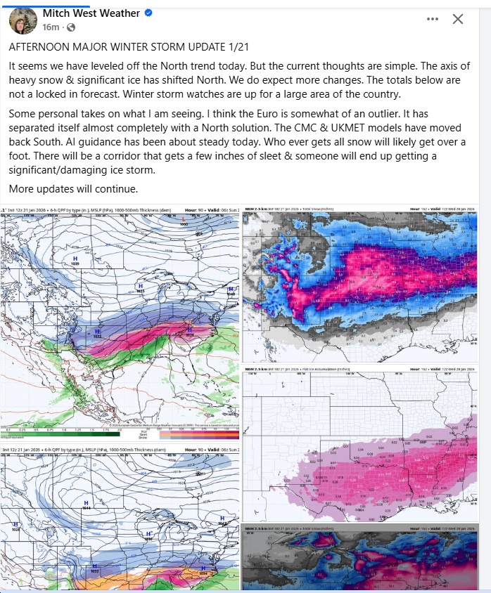
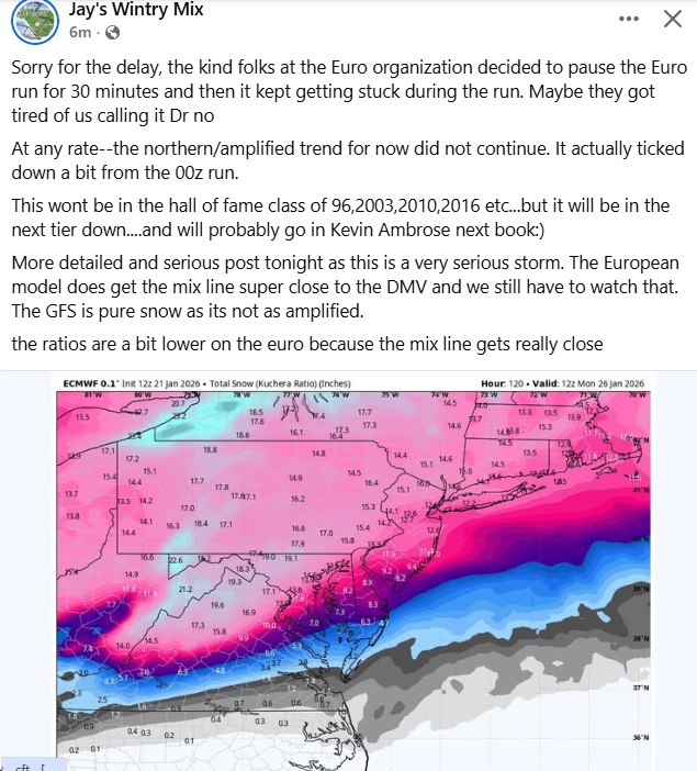
UPDATE 1:35 pm Wednesday:
- Noon Wednesday update:
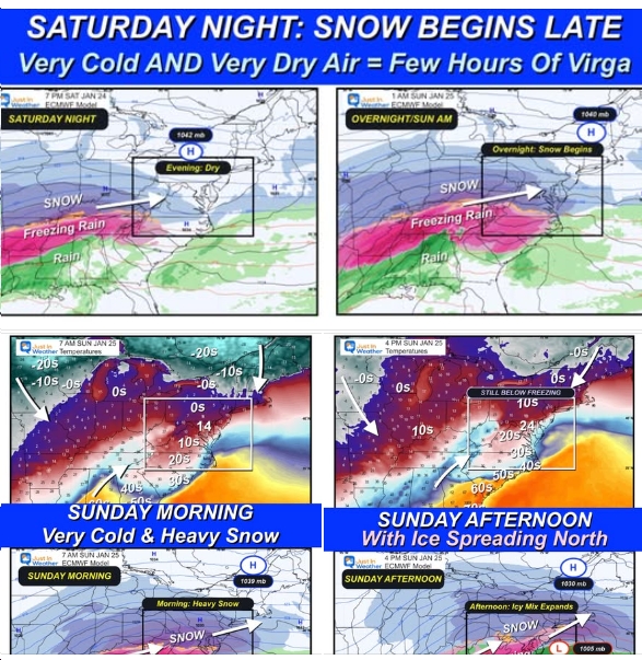
- So…as of 10:30 am Wednesday, according to Justin Berk: “Sunday Morning = Heavy Snow!”; “Sunday Afternoon/Evening Ice spreading northward into Maryland”; “Schools likely to be closed as a realist on Monday and cleanup will be slow into Tuesday with temps remaining well below freezing.”
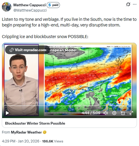
- Check out this video by Matthew Cappucci (from Tuesday at 4:29 pm):