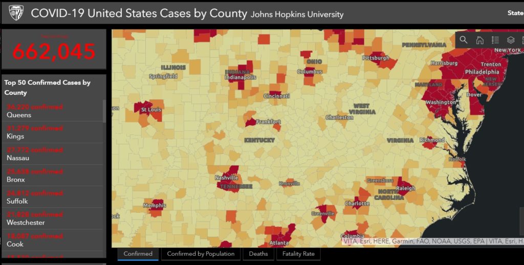
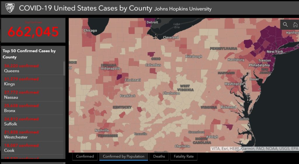
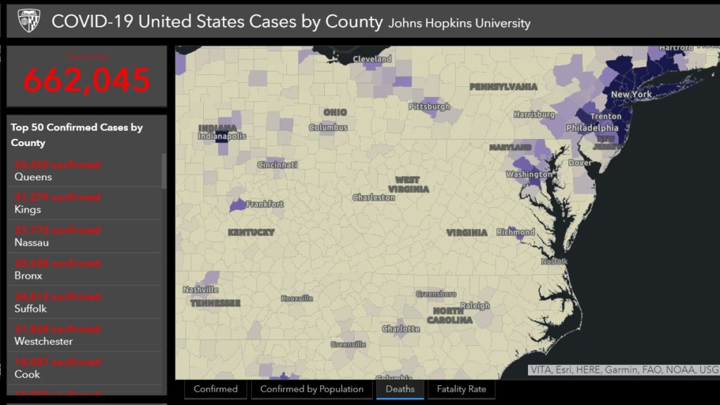
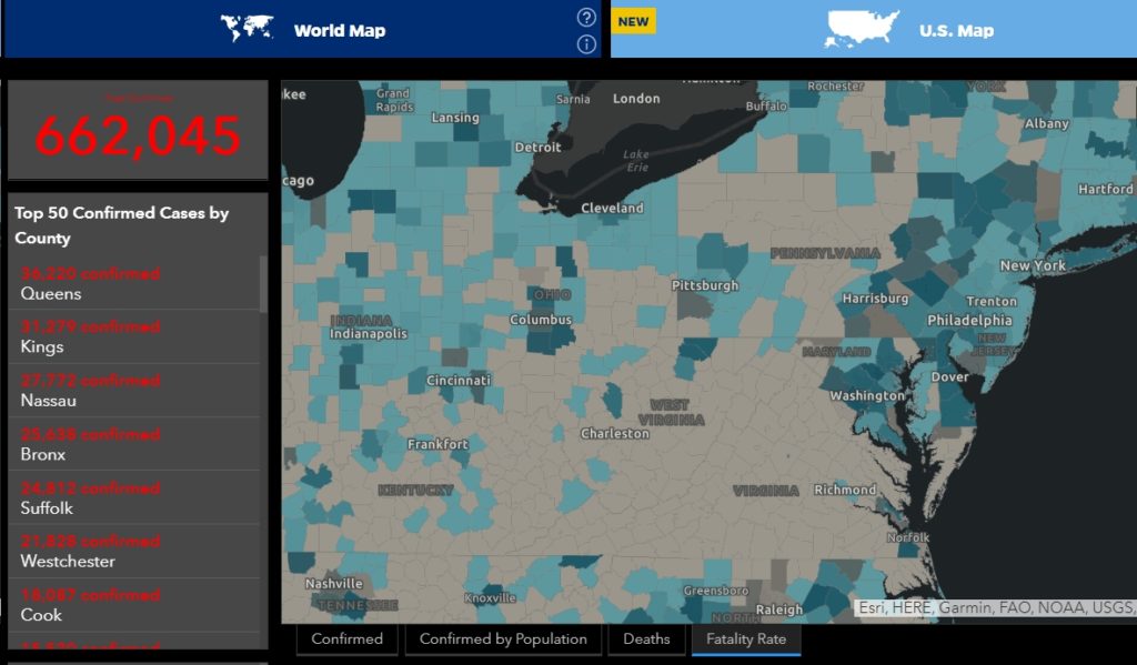
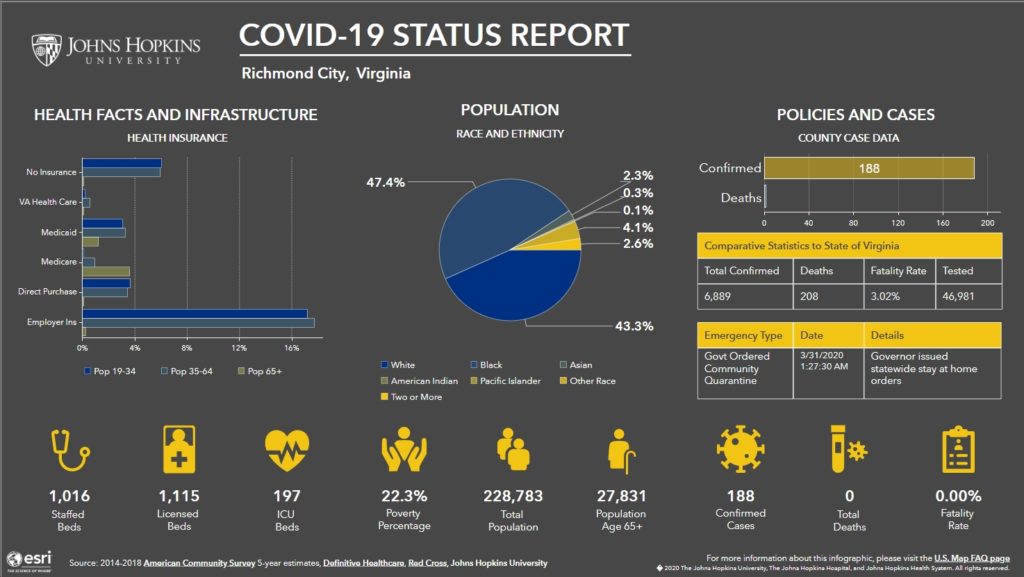
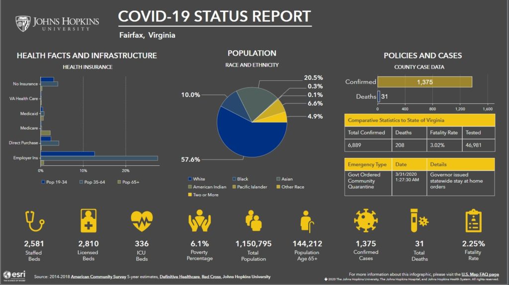
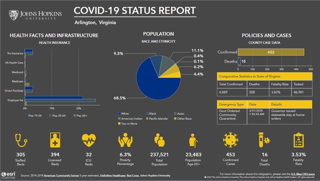
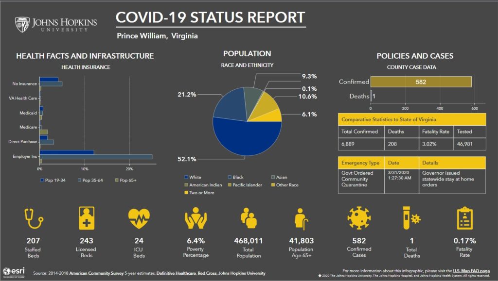
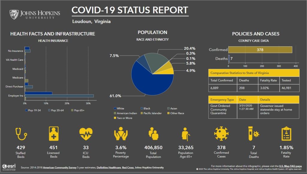
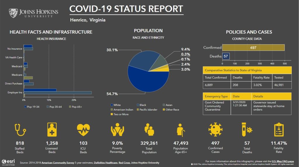
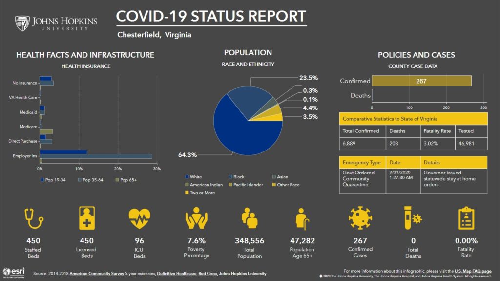
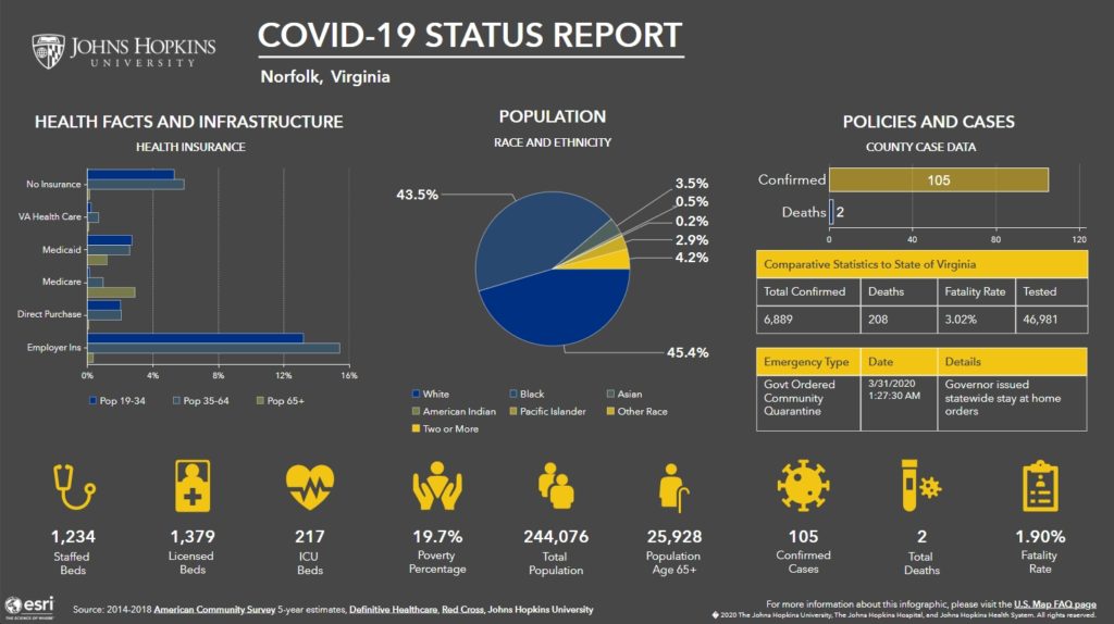
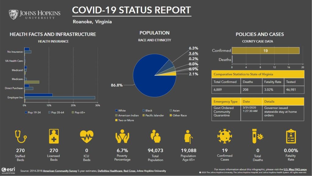
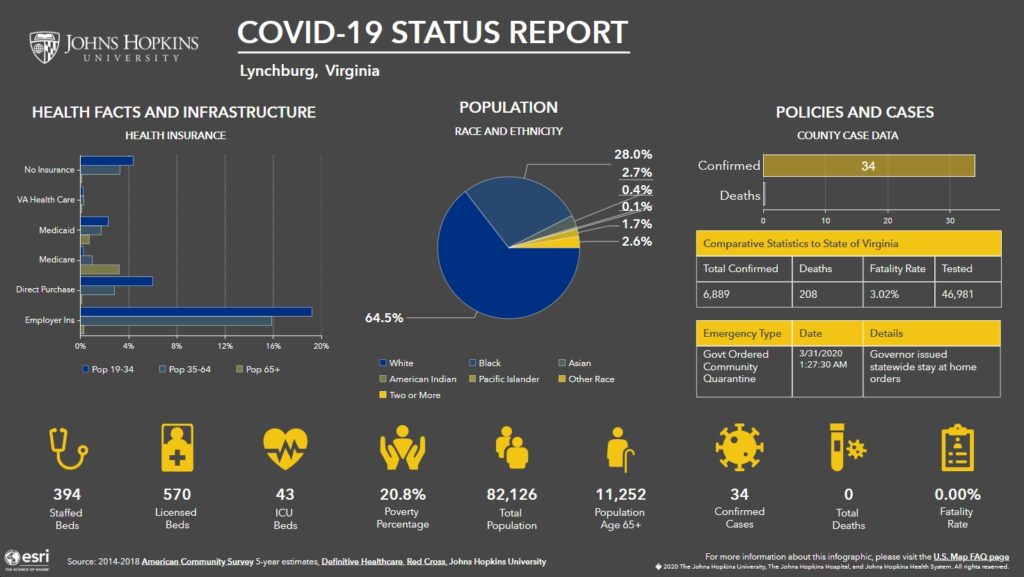
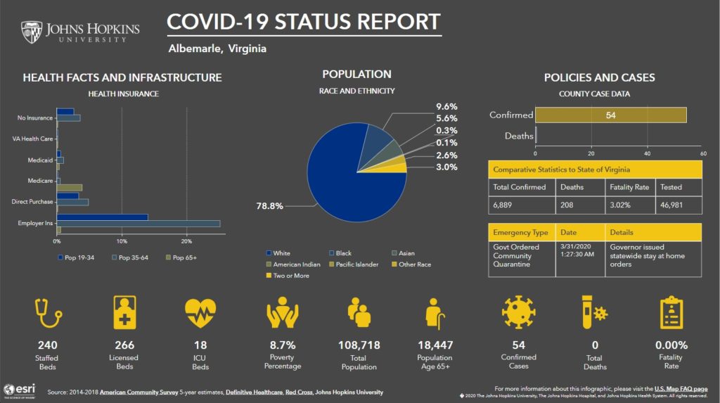
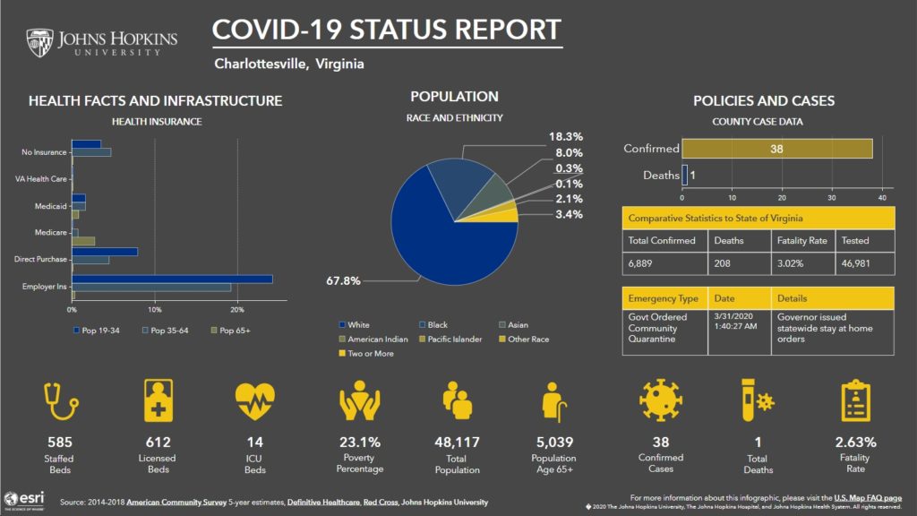
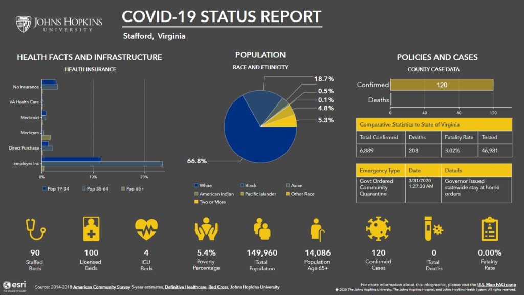
If you haven’t seen it yet, here’s a link to the new “data-rich, U.S.-focused coronavirus tracking map” by Johns Hopkins University, featuring “county-level infection and population data, allowing policymakers, the media, and the public to find specific, up-to-date information about the outbreak and how it is affecting communities across the nation.” See below for maps of Virginia and some of the biggest counties and cities within Virginia.




![Thursday News: “World leaders now enter the White House at their own risk”; “2 Israeli Embassy staff shot and killed in front of Capital Jewish Museum in DC”; GOP Moves to Pass “Monstrous” Bill Which “steal[s] from the poor and give[s] to the rich”](https://bluevirginia.us/wp-content/uploads/2025/05/montage0522-238x178.jpg)


![Monday News: Trump’s Lunacy Pushes China, Russia, India, etc. Together; “Happy Labor Day. Donald Trump and Elon Musk Are Screwing Workers.”; “Where is the [media’s] intense focus on Trump’s failing health?”; ““Trump says he is not a dictator. Isn’t he?”](https://bluevirginia.us/wp-content/uploads/2025/09/montage0901-100x75.jpg)