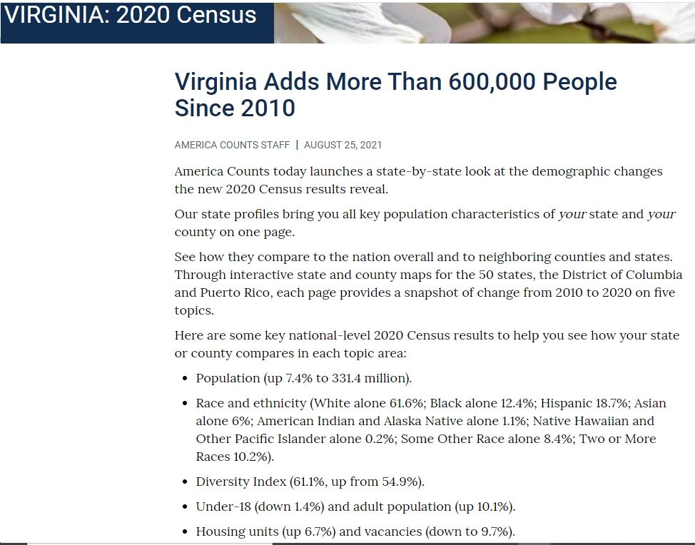
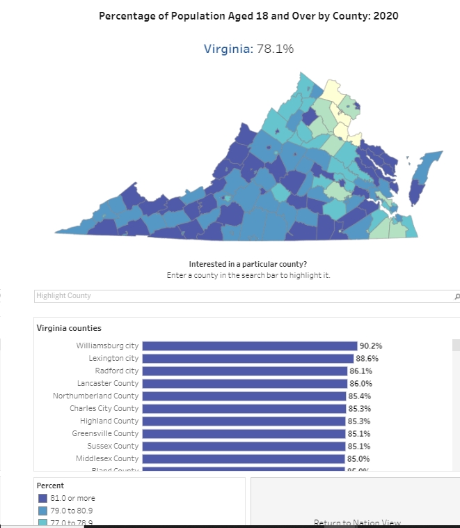
There’s lots of really interesting data in this new dump by the U.S. Census Bureau, as “America Counts today launches a state-by-state look at the demographic changes the new 2020 Census results reveal.” Here are a few highlights for Virginia:
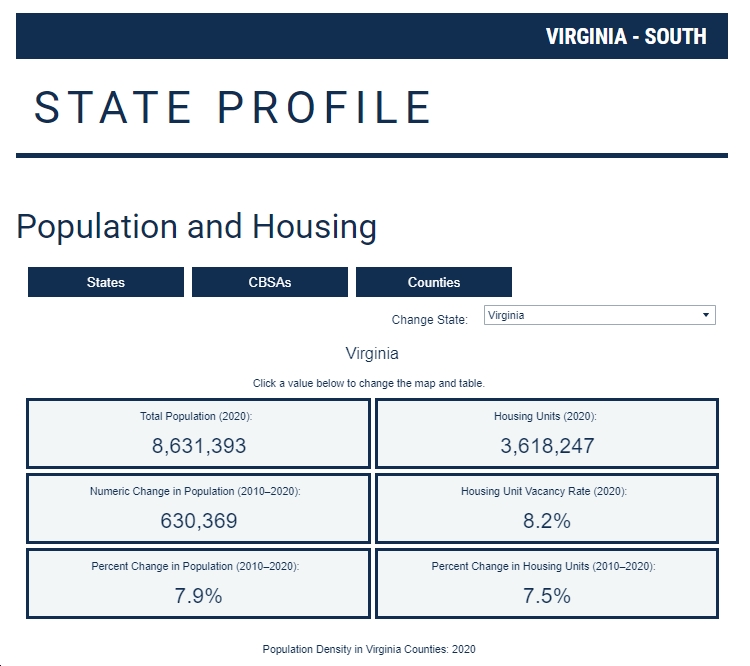
- Virginia’s population reached 8,631,393 in 2020, up 7.9% (630,369) since 2010
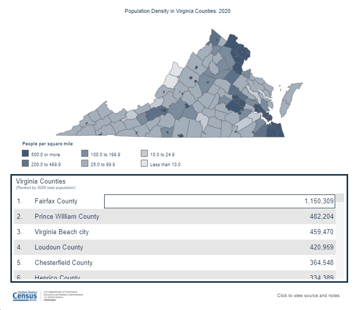
- The most-populated county is Fairfax, with 1,150,309 people (13.3% of Virginia’s population). Add in Prince William County (482,204), Loudoun County (420,959), Arlington County (238,643), Alexandria (159,467) and we’re talking about 2.4 million people, or 27.8% of Virginia’s population, in core/inner Northern Virginia. Add in Fairfax City, Falls Church, Manassas, and Manassas Park and we’re up to 2.5 million people, or 28.9% of Virginia’s population, in core/inner Northern Virginia.
- Population density, not surprisingly, is highest in the urban/suburban “crescent” from NoVA to the Richmond area to Hampton Roads. Population density is lowest in rural western, southwestern, Southside and eastern Virginia.
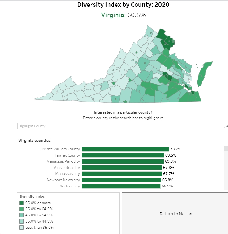
- The lowest diversity indices are seen in rural western and southwestern Virginia, with the highest diversity indices in northern Virginia, Hampton Roads, and the Richmond area.
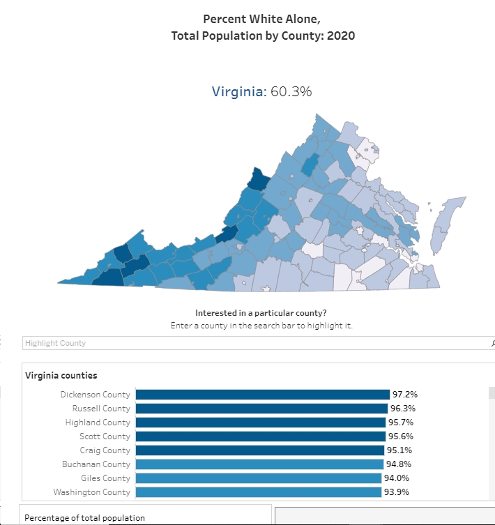
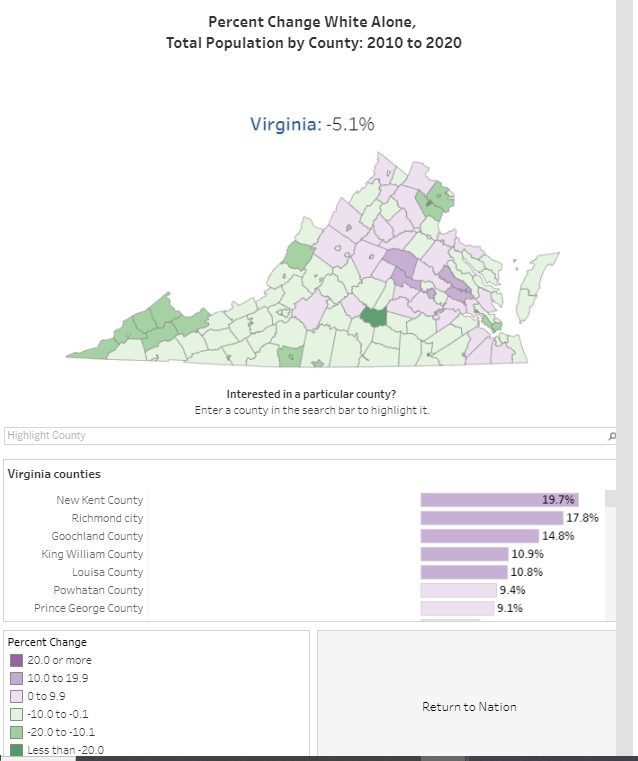
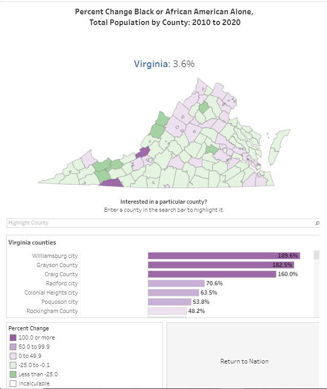
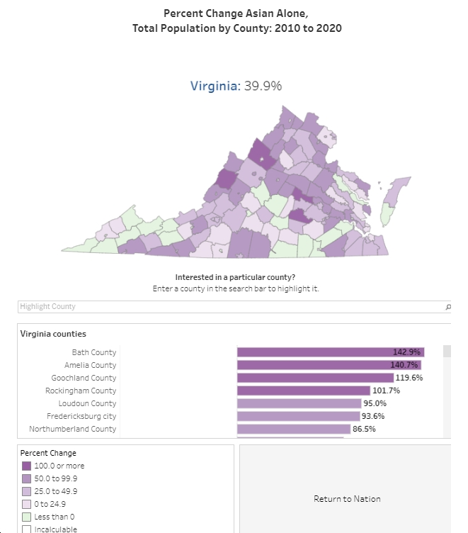
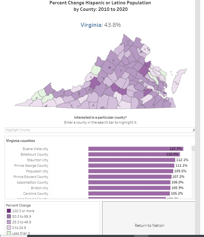
- The White population fell sharply in many counties in southwestern Virginia. The Asian and Hispanic populations grew rapidly in large swaths of Virginia, with the exception of parts of far-Southwestern Virginia and parts of Southside Virginia.
- What else jumps out at you?
********************************************************


 Sign up for the Blue Virginia weekly newsletter

![Monday News: “US popularity collapses worldwide in wake of Trump’s return”; “Trump defends the [indefensible] prospect of Qatar gifting him a plane to use as Air Force One”; Trump Removes Tariffs After Adding Tariffs After…; “Is Jeff Bezos Ruining the [WaPo]?”](https://bluevirginia.us/wp-content/uploads/2025/05/montage0512-238x178.jpg)


