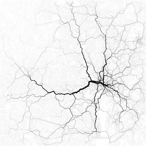
 Eric Fischer created this map of Washington, DC using Twitter data from August 2011:
Routing 30,000 randomly-chosen trips through the paths suggested by 10,000 randomly-chosen geotags. These are perhaps the most interesting routes between the endpoints of the trips, even if not necessarily the most likely.
Note that the routes go in & out of the city center, not around it. Makes you wonder who Gov. Bob McDonnell is really working for when he pushes terrible, incredibly expensive ideas like the Outer Beltway.
![Rep. Don Beyer (D-VA08) on “reports of the devastating effects Donald Trump’s Project 2025 agenda would have on [Metro]”](https://bluevirginia.us/wp-content/uploads/2024/10/trumpmetro.jpg)