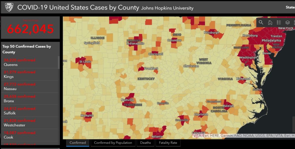
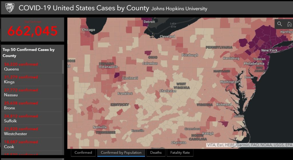
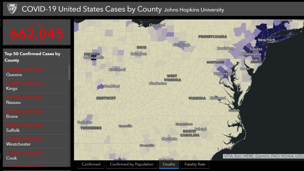
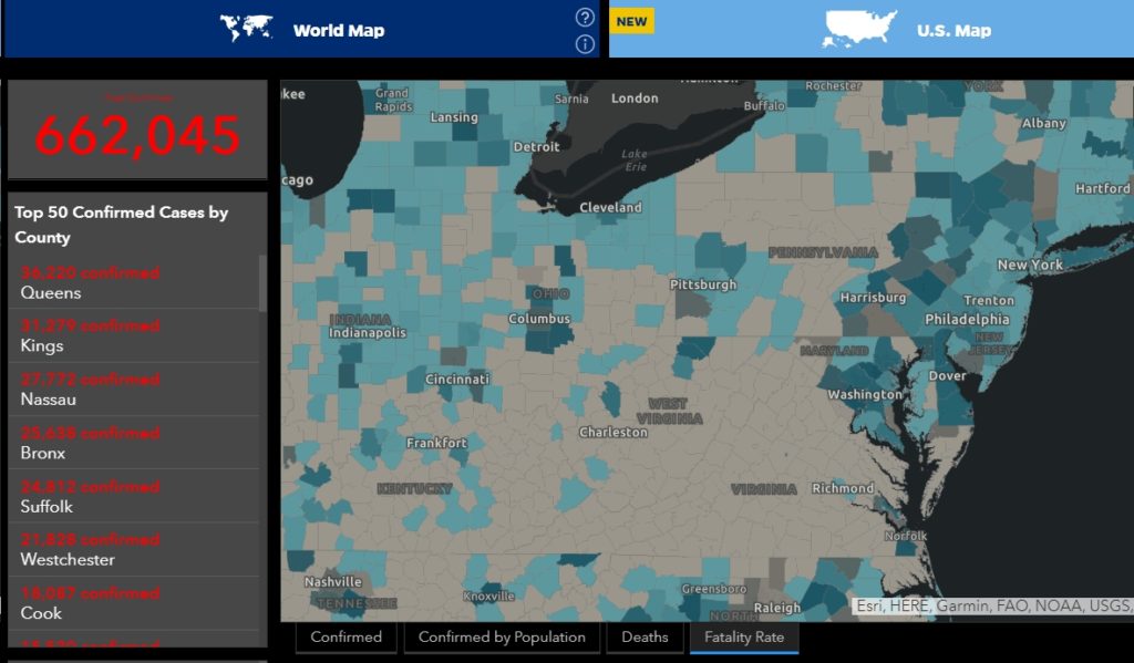
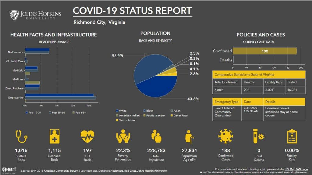
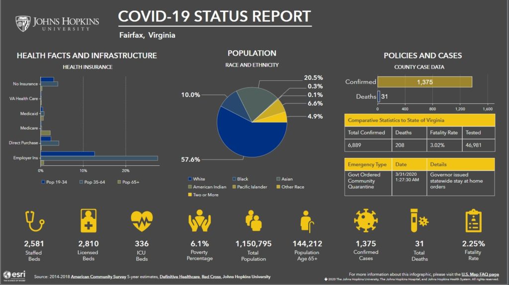
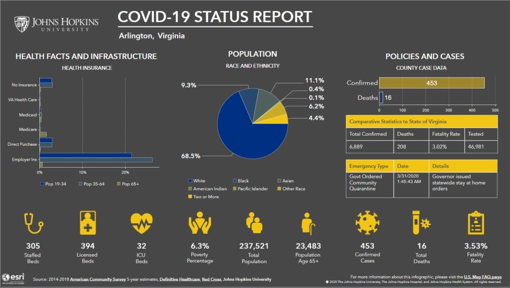
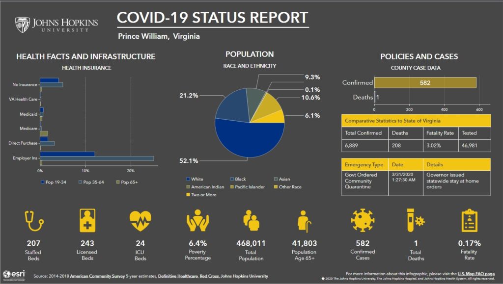
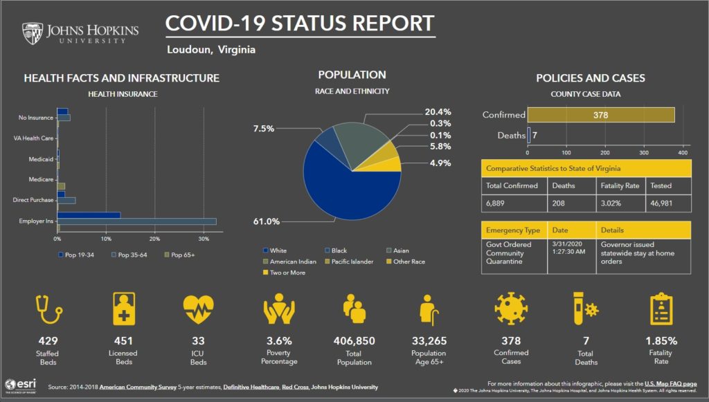
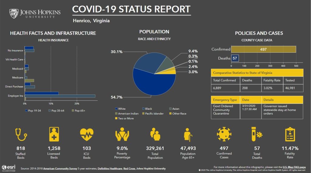
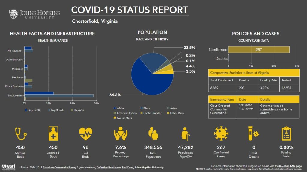
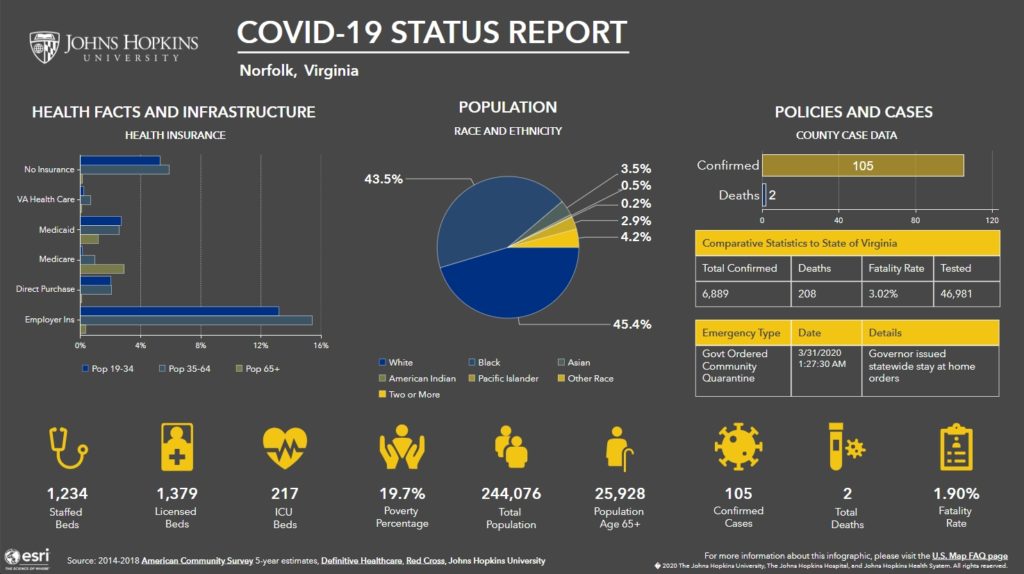
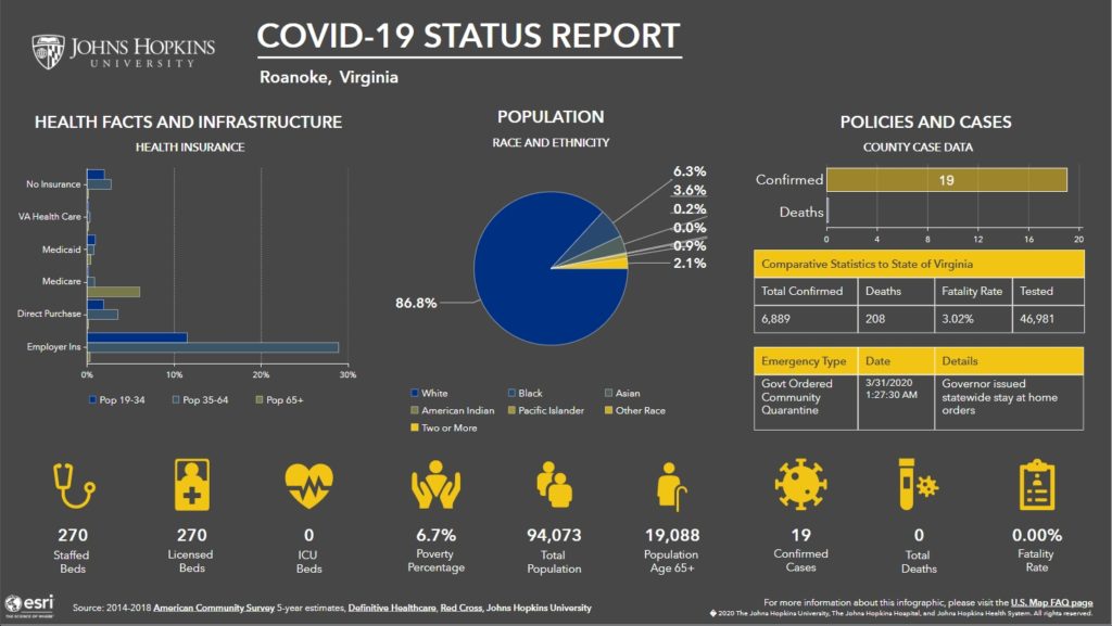
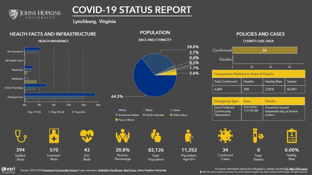
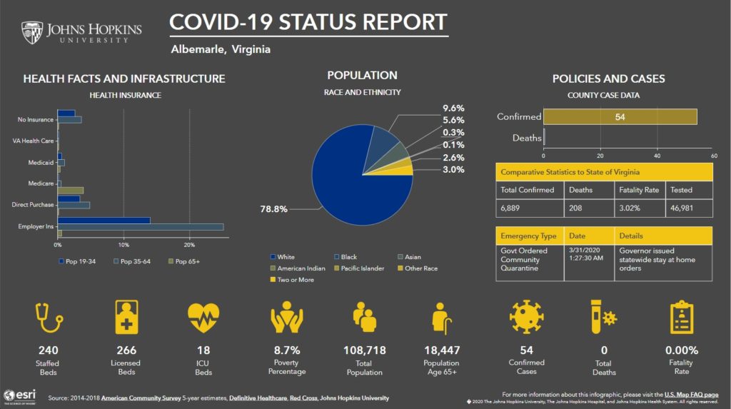
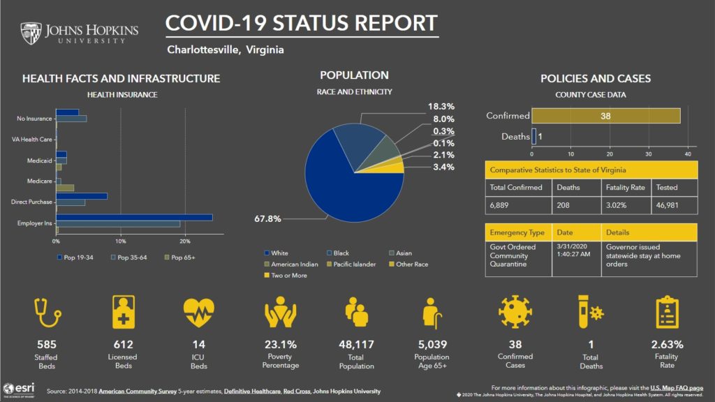
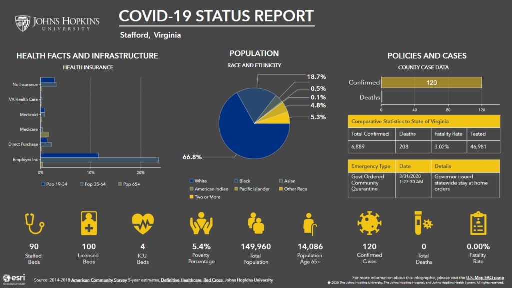
If you haven’t seen it yet, here’s a link to the new “data-rich, U.S.-focused coronavirus tracking map” by Johns Hopkins University, featuring “county-level infection and population data, allowing policymakers, the media, and the public to find specific, up-to-date information about the outbreak and how it is affecting communities across the nation.” See below for maps of Virginia and some of the biggest counties and cities within Virginia.